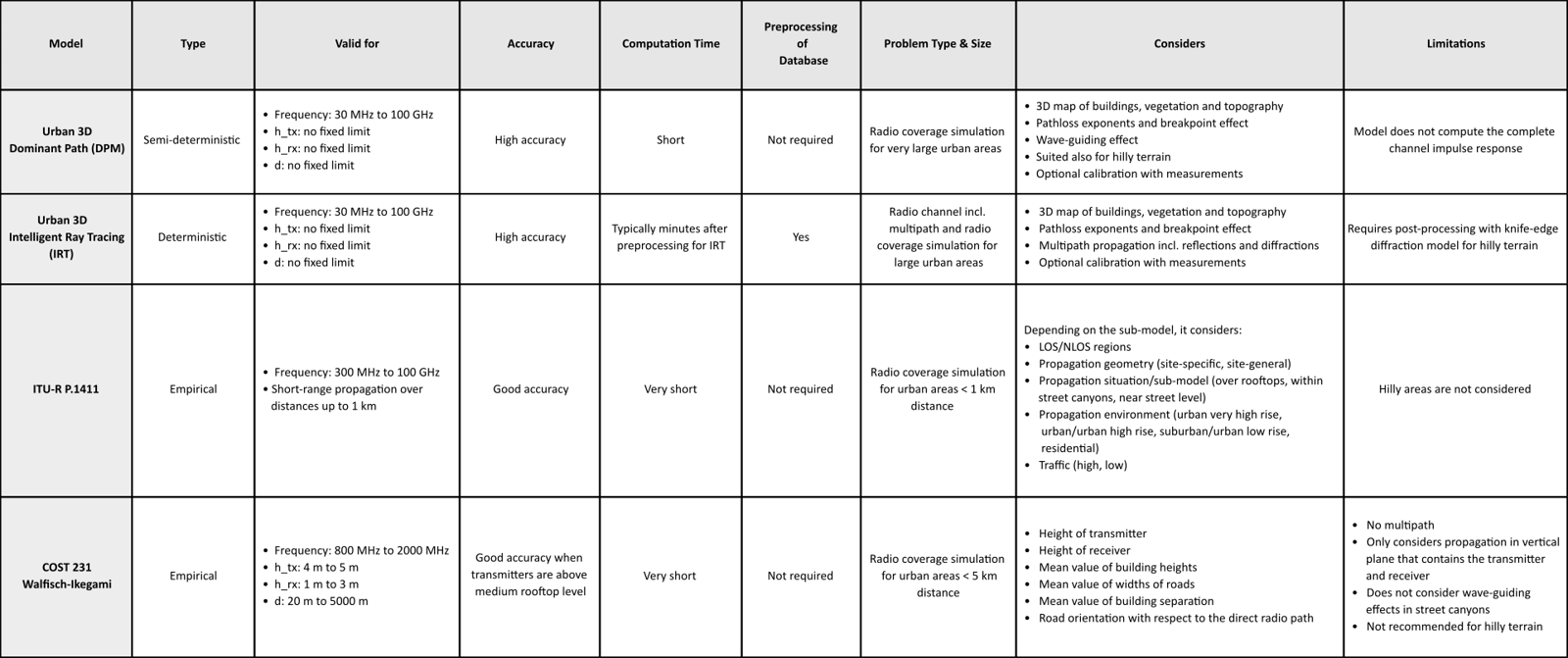
This article provides a summary of the wave propagation models supported in WinProp for urban scenarios.
An urban scenario is typically a built-up area, which could be a whole city, but also a suburban or residential part, a campus, factory, or similar environments. Each building or vegetation object is described by a polygonal ground plane and an individual height above street level using polygonal cylinders. If the urban area is not flat, the topography can be included.

An example of an urban database showing the received power.
Typical applications include (but not limited to) the evaluation of wireless connectivity along a road near an LTE base station or the analysis of a radio network.
The following wave propagation models are supported for urban scenarios:
- Urban Dominant Path Model (DPM)
- Urban 3D Intelligent Ray Tracing (IRT) model
- ITU-R P.1411
- COST 231 Walfisch-Ikegami
Table: Summary of urban wave propagation models in WinProp.
Click to enlarge table.

Related content