Hello everyone,
I am having trouble exporting the mesh from Hypermesh. Some white spaces separating the fields are missing.
*) With the RADIOSS profile, the first three nodes of the grid data look like this.
1 10.4352852680878 0.374999999999996 1.69690861652916
2 10.0920996147679-3.8857805861880E-15 1.59540682856021
3 10.2957517115474-3.5527136788005E-15 1.49409343503715
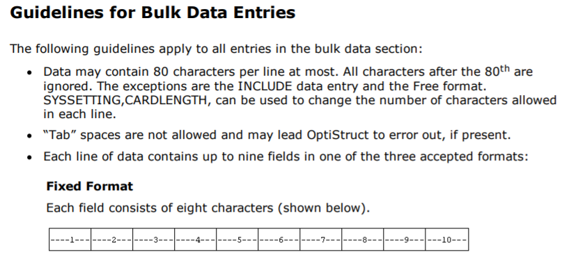
*) The situation is even worse with OptiStruct. The output file (first three nodes) looks like this.
GRID 1 10.435290.375 1.696909
GRID 2 10.0921 0.0 1.595407
GRID 3 10.295750.0 1.494093
I don't want to create white space manually because the meshes I work with, in general, contain thousands of nodes. So, I need a proper solution for this issue. I am using the HyperWorks14.0 - student version.
Thanks,
Chenna.